Short Hikes Icefields Parkway: 13 Trails to Savor
Why traverse the Icefields Parkway by car in one day when there’s so much more beauty to be seen and experienced? If you’re willing to stray from the beaten path, you might experience some pleasant surprises. In this post, you’ll find 13 one-day hikes near this famous road worth checking out.
It’s easy to quickly ‘snack’ all the highlights along the Icefields Parkway. The ‘world’s most beautiful road’ was designed to ingest all this stunning scenery from the convenience of your car. Some destinations along the road actually require you to get out of your vehicle, but you can still park very close to the attraction.
This allows you to take some quick snapshots, mutter ooh and aah in admiration of all this beauty and get back in your car. Then rinse and repeat at another beautiful spot along the highway.
Now, it doesn’t have to be like this, as you’ve read in the introduction to this article. Just strap on those sturdy hiking boots on and go do some hiking. You won’t be disappointed. To make things not too crazy and time-consuming, I compiled a list below of short, one-day hikes easily accessible from the Icefields Parkway.
I listed them in order of appearance along the Icefields Parkway, with Lake Louise Village as your starting point. If you’re coming from the direction of Jasper, the last listed hike will be your first opportunity.
If you have a disability or you are physically challenged, the hikes you’ll find below might not be possible for you. This does’t mean you can’t enjoy the beautiful Icefields Parkway. Check the post How Accessible is Banff for Disabled Persons to find out.
Herbert Lake
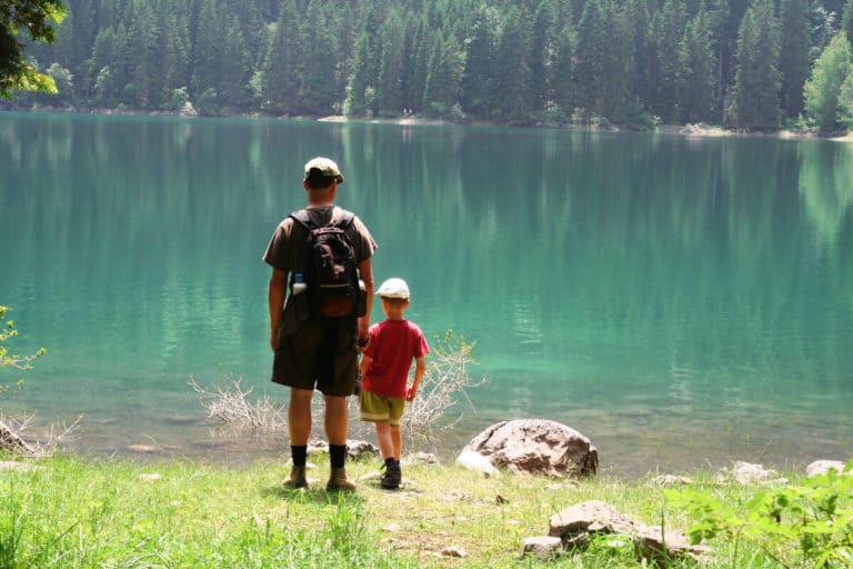
This loop takes you along the first lake on the Icefields Parkway, coming from the direction of Lake Louise. It’s a short and easy hike with hardly any altitude meters, making it a perfect little walk for families. The lakeshore is hugged by a dense forest allowing for some lovely shade on a sweltering day. This is one of the few lakes in the park which allows for a swim as the water temperature is not as cold as most other (glacial) lakes. You’ll even find a diving board inviting you to jump in.
Trailhead
There’s a small parking lot on your left-hand side coming from the direction of Lake Louise. There are picnic tables and bathrooms. Close to there’s a sign indicating the trailhead.
Distance: 1.6 km (0.99 mi)
Elevation: 42 m (13 ft)
Duration: 0.5 h
Hector Lake Hike
The hike takes you to Hector Lake. It is probably the most challenging or adventurous route on the list. Not because of the distance or altitude difference. Both are okay. It’s because of the significant river ford. So make sure to pack an extra pair of shoes and some old, water-resistant footwear. Also make sure that you bring a sturdy pair. The river bed can be rocky and slippery.
Furthermore you need to be cautious about the river’s water level. The best month to do this hike is August, when the water level is not too high. Because Hector Lake is relatively far from the Icefields Parkway, you can walk in relative solitude, particularly beyond the water ford. Not many people are willing to wade through the river.
Trailhead
The Hector Lake Hike starts at the parking lot on the left side of the Icefields Parkway (coming from the direction of Lake Louise). It’s a pull-out. A small sign indicates the trailhead of the Hector Lake Hike.
Distance: 4.5 km (2.79 mi)
Elevation: 107 m (351 ft)
Duration: 1 – 1.5 hrs
Mosquito Creek Hike
At 10 kilometers (6.2 mi), this is one of the longer hikes on the list. The path leads you to Mosquito Creek and ultimately to the Mo5 Campground over a winding trail and you’ll get some excellent views of Noseeum Mountain (3,000 meters / 9,843 ft). Because you’re mainly walking through the valley, this hike is not strenuous at all and therefore a good hike for families despite its length.
Trailhead
The trail starts across the road at the Mosquito Creek Wilderness Hostel. You can park your car along the Icefields Parkway at the exit to the campground and hostel.
Distance: 10.0 km (6.2 mi)
Elevation: 422 m (1385 ft)
Duration: 3 – 4 hrs
Bow Glacier Falls Hike
This hike along Bow Lake is mostly flat, making it a relatively easy effort. Passing the Num-Ti-Jah Lodge, you’ll find a path providing magnificent views in all directions. When you encounter a set of stairs, keep right for the Bow Glacier Falls. The left turn will take you to the Bow Hut. After the steps, the trail is relatively straightforward. Just keep following it and you’ll end up at the falls.
Trailhead
Park your car at the Bow Lake parking lot and turn right, towards the Num-Ti-Jah Lodge. There you’ll find the path, following the lake.
Distance: 8.4 km (5.21 mi)
Elevation: 155 m (509 ft)
Duration: 2 – 2.5 hrs
Bow Lake Hike
Another easy and not too long hike along a lake. The Bow Lake trail is almost entirely flat, making for a pleasant family-friendly walk. The path skirts the lakeshore, providing gorgeous views in all directions. It’s an out-and-back trail, so you can keep going as long as you want. The trail’s ‘end’ is marked by a wooden staircase. You can turn around here, or if you have the time and energy for it, continue to the Bow Hut (left turn, a pretty strenuous hike) or the Bow Falls (right turn, intermediate difficulty, see above).
Trailhead
Park your car beside the Icefields Parkway on the Bow Lake parking lot and turn towards the Num-Ti-Jah Lodge on your right.
Distance: 3.4 km (2.11 mi)
Elevation: 2 m (7ft)
Duration: 0.5 – 1 h
Peyto Lake Hike

The hike isn’t challenging and your main goal is getting to the Peyto Lake viewpoint. It’s an easy walk with, generally, lots and lots of tourists due to the famous and absolutely stunning view that’s up ahead. It only takes you 650 meters to get to the viewpoint. After that, you continue the loop back to the parking lot. The hike is well-suited for families with small kids. And the lake is an absolute must-see.
Trailhead
The trail starts at the perimeter on the northwest end of the parking lot. A sign indicates the path.
Distance: 2.6 km (1.61 mi)
Elevation: 80 m (262 ft)
Duration: 0.75 – 1 h
Bow Summit Hike
The big crowds that flock to this trail might deter you. Still, go do this hike; you won’t regret it. Sure, up till the viewing point, the path is bustling during the summer months. For a good reason, because it provides you with a mouth-dropping view of this famous lake. You’ll leave most tourists behind once you’ve continued beyond the viewpoint. This is where the trail inclines quite a bit, but the stunning views, allowing for a much broader view of the valley, will make it worthwhile.
Trailhead
The trail starts at the northwest end of the Peyto Lake Parking lot. It is easy to find as it’s not from the Icefields Parkway. The exit to the lake is well indicated.
Distance: 6.6 km (4.09 mi)
Elevation: 313 m (1027 ft)
Duration: 2 – 3 h
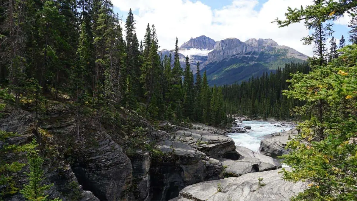
Mistaya Canyon Hike
This easy trail takes you to the thundering water of Mistaya Canyon. Despite being right along the Icefields Parkway, this family-friendly loop is not that busy. Because of its short length, Mistaya Canyon offers an excellent opportunity to stretch your legs and enjoy the nature you’ve driven through without spending too much time on a hike. The Mistaya River, which springs from Peyto Lake, runs through the canyon. The bridge across the canyon allows for a stunning vista and awe-inspiring photographs.
Trailhead
The trailhead begins at the Mistaya Canyon parking lot, which is right beside the Icefields Parkway and easy to find.
Distance: 1.8 km (1.12 mi)
Elevation: 79 m (259 ft)
Duration: 0.5 – 1 h
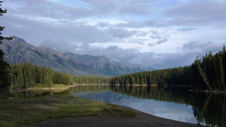
Waterfowl Lake Trail
At 1.4 kilometers (0.87 mi), this hike is the shortest on this list. There are two Waterfowl Lakes. The path leads you to Upper Waterfowl Lake, the most beautiful of the two. It is an ideal hike for families as the trail is nearly flat, wide and well-maintained. During the hike you’re treated to some stunning views of Mount Chephren.
Trailhead
You will find the trailhead at the Waterfowl Lakes Campground on the left-hand side of the Icefields Parkway, coming from the direction of Lake Louise.
Distance: 1.4 km (0.87 mi)
Elevation: 34 m (112 ft)
Duration: 0.5 h
Warden Lake Trail
The Warden Lake trail is yet another family-friendly hike, leading you along the North Saskatchewan River. The abundance of vegetation in this part of the valley makes wildlife frequent the area. After about 2 kilometers (1.24 miles), the trail takes a right turn sending you into the woods as it leads you to Warden Lake. It’s a nice place to relax and maybe dip in the cold water on a sweltering day before you hike back.
Trailhead
Coming from the direction of Lake Louise, there’s a car park on your left-hand side, right across a road exit and just before the river. The entrance to the parking lot is a pretty small dirt road, so pay attention. After you’ve parked your car, cross the road to get to the trailhead. It’s near the road exit.
Distance: 4.7 km (2.91 mi)
Elevation: 15 m (49 ft)
Duration: 1 h
Panther Falls Trail
A short trail, perfect for stretching your legs after a long drive. The trail takes you to a beautiful 66-meter (217 ft) high waterfall, its thundering sound already audible from the parking lot. Which indicates it’s not far away. A dirt path leads up to the Panther Falls. The cool thing is that you can actually get to the water’s edge. Also cool: Because this hike is overlooked by most tourists, it’s generally not too busy on the trail, even in summer.
Trailhead
To find the trailhead, park your car in the parking lot, a large pull-out on the Icefields Parkway after the Big Bend Hill. There’s no sign indicating where to start your hike, but finding the trailhead shouldn’t be too difficult.
Distance: 1.3 km (0.81 mi)
Elevation: 75 m (246 ft)
Duration: 0.5 h
Parker Ridge Trail
This mesmerizingly beautiful trail provides several views of the Saskatchewan Glacier, the largest and longest outflow glacier on the Columbia Icefield. You’ll have to cross a small meadow at the beginning of the trail before you enter a subalpine forest. The trail switchbacks through the woods and above the tree line. Once you’re there, you have a splendid view of the peaks around you, including Mount Athabasca (3491 m / 11,453 ft). The trail splits in two opposite directions along the windswept ridge top.
The path on your right-hand will take you higher. The official trail, however, will take you south along the ridge to the Saskatchewan Glacier, providing amazing viewpoints over the Saskatchewan River. While this location might seem like an excellent ending point of the trail, it still continues, although it doesn’t offer some spectacular new views. So you might as well turn around at the Saskatchewan Glacier viewpoint.
Trailhead
You can park your car on the opposite side of the Icefields Parkway. It’s a pretty wide stretch of asphalt bordering the highway. Cross the highway and you’ll find a sign indicating the trailhead.
Distance: 5.9 km (3.66 mi)
Elevation: 250 m (820 ft)
Duration: 1.5 – 2.5 hrs
Wilcox Pass Trail
This hike begins near the road leading up to the Wilcox Creek Campground. This slightly longer hike takes you to the top of Mount Wilcox. It offers you plenty of stunning views of the Sunwapta Pass, which makes the effort worthwhile because this hike is somewhat challenging to most people. Also because it starts at 2040 meters (6693 ft), which makes for a bit thinner air.
Located only 2.7 km (1.67 mi) south of the Icefields Centre, it’s a popular trail, so expect other people, especially in summer. You’ll get a fantastic view of the famous Athabasca Glacier on the Columbia Icefield at the summit.
Trailhead
You’ll find the trailhead off the road leading to the Wilcox Campground. It’s in a right corner on the left-hand side.
Distance: 11.4 km (6.84 mi)
Elevation: 414 m (1358 ft)
Duration: 3 – 4 hours
If you want to know how to get the most from your action camera in the park, I recommend reading the post Practical Guide to Recording Thrilling GoPro Videos in Banff.
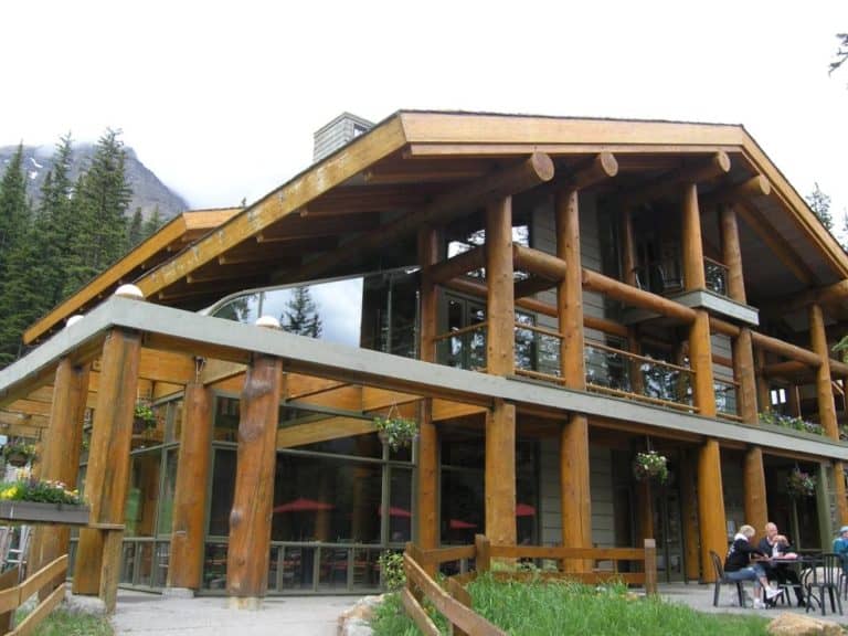
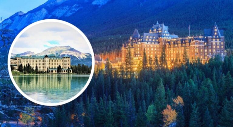
Spending the Night along the Icefields Parkway
Although the abovementioned hikes are all relatively short, doing one or two could make you want to spend the night somewhere along the road. The Icefields Parkway is long and after your hike, you could still have quite some driving left to reach Lake Louise or Jasper. Besides, driving the road in the dark would mean sacrificing beautiful landscapes, vistas and some wild Instagram magic.
You have two options. Either you stay in a hotel, motel or hostel along the road (there are several), or, if you’re tenting, you stay at one of the six campgrounds. You’ll find all your options in the table below, including the nearest hike and the distances to Jasper and Lake Louise. It should help you cleverly choose where to spend the night.
There’s a caveat to this, however. If you’re going to hike one of the routes above in summer – which is quite likely – you could find that your lodging of choice is booked full. So either make sure you book well before you undertake your hikes or plan for an alternative place (or two) to stay.
I wouldn’t recommend spending the night in your car as a last resort. Not only is it very uncomfortable, nights along the Icefields Parkway tend to be cold, also in summer.
If you want to learn more about spending the night along the Icefields Parkway, I recommend reading the comprehensive post The Ultimate Guide to the Icefields Parkway.
Distance Table
I put all 13 hikes described above in a handy table for your convenience. It allows you to see the length and the duration of the diverse hikes at a glance, among other helpful information.
| Hike | Distance | Elevation | Duration | Distance to Lake Louise | Distance to Jasper |
|---|---|---|---|---|---|
| Herbert Lake Hike | 1.6 km (0.99 mi) | 42 m (13 ft) | 0.5 hour | 7.4 km (4.59 mi) | 226 km (140 mi) |
| Hector Lake Hike | 4.5 km (2.79 mi) | 107 m (351 ft) | 1 – 1.5 hours | 22.9 km (14 mi) | 211 km (131 mi) |
| Mosquito Creek Hike | 10.0 km (6.2 mi) | 422 m (1385 ft) | 3 – 4 hours | 28.4 km (18 mi) | 205 km (127 mi) |
| Bow Glacier Falls Hike | 8.4 km (5.21 mi) | 155 m (509 ft) | 2 – 2.5 hours | 38.7 km (24 mi) | 195 km (121 mi) |
| Bow Lake Hike | 3.4 km (2.11 mi) | 2 m (7ft) | 0.5 – 1 hour | 38.7 km (24 mi) | 195 km (121 mi) |
| Peyto Lake Hike | 2.6 km (1.61 mi) | 80 m (262 ft) | 0.75 – 1 hour | 45.5 km (28 mi) | 188 km (117 mi) |
| Bow Summit Hike | 6.6 km (4.09 mi) | 313 m (1027 ft) | 2 – 3 hours | 45.5 km (28 mi) | 188 km (117 mi) |
| Mistaya Canyon Hike | 1.8 km (1.12 mi) | 79 m (259 ft) | 0.5 – 1 h | 75.1 km (47 mi) | 158 km (98 mi) |
| Waterfowl Lake Trail | 1.4 km (0.87 mi) | 34 m (112 ft) | 0.5 h | 62.2 km (39 mi) | 171 km (106 mi) |
| Warden Lake Trail | 4.7 km (2.91 mi) | 15 m (49 ft) | 1 h | 83.3 km (52 mi) | 156 km (97 mi) |
| Panther Falls Trail | 1.3 km (0.81 mi) | 75 m (246 ft) | 0.5 h | 116 km (72 mi) | 117 km (73 mi) |
| Parker Ridge Trail | 5.9 km (3.66 mi) | 250 m (820 ft) | 1.5 – 2.5 hrs | 121 km (75 mi) | 113 km (70 mi) |
| Wilcox Pass Trail | 11.4 km (6.84 mi) | 414 m (1358 ft) | 3 – 4 hours | 128 m (79 mi) | 106 km (66 mi) |