The Top Ten Highlights Of Banff National Park
A list of the ten highlights of anything is always subjective, and this one is no different. Still, most people who have visited Banff National Park will probably agree with this top ten. Although the order could be the subject of debate.
Whatever you think of this list, it is a helpful guide if you want to know which locations in the park you absolutely must see. And rest assured, if you’ve managed to visit all ten sites, there are still many dozens of other places in the park that are worth visiting.
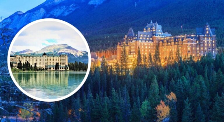
10. FAIRMONT BANFF SPRINGS HOTEL
Of course, you visit Banff mainly for nature, but we start this top ten with a building. Not without reason, because the Banff Springs Hotel is not just any hotel. Or building. It is grand and majestic. You could say that the château-style of the hotel perfectly fits into its surroundings. Famous are the photographs of this stately abode at the foot of Rundle Mountain.

The hotel opened in 1888 as one of Canada’s Grand Railway Hotels, three years after the founding of Banff National Park. In 1914, “The Banff Springs” was expanded. Twelve years later, a fire destroyed the then essentially wooden hotel, after which it was rebuilt in stone. Since 1988 the hotel has been considered a National Historic Site Of Canada.
The Fairmont Banff Springs Hotel is located at 1414 meters (4639 feet) and has as many as 757 rooms and suites. If you want to stay here, you will have to pony up quite a bit of cash. Room rates start at a good CAD 400 per night, and that’s in the low season (April / November). Expect to pay more than CAD 800 per night in the high season.
If you find this too expensive, the hotel is still worth visiting. See the impressive lobby, the equally impressive staircase, visit the stores in the extensive shopping area or have a drink and a meal in one of the bars or restaurants.
Address: 405 Spray Avenue, Banff
9. MORANT’S CURVE
Perhaps one of the most iconic photos from Banff National Park, a train winding through Morant’s Curve. There is something idyllic about it, that lonely track beside the turquoise-green waters of the Bow River with the forested Rockies in the background. Otherwise seemingly no trace of civilization.

The place got its name from Nicholas Morant, the Canadian Pacific Railway photographer. Although there are countless beautiful pieces of track to be found in the Rockies, this one is extra special. If only because the picture he took of this track ended up on Canadian currency and stamps.
You can easily visit this spot from the Bow Valley Parkway, connecting Banff to Lake Louise.
Location: 51.3996° N, 116.1287° W
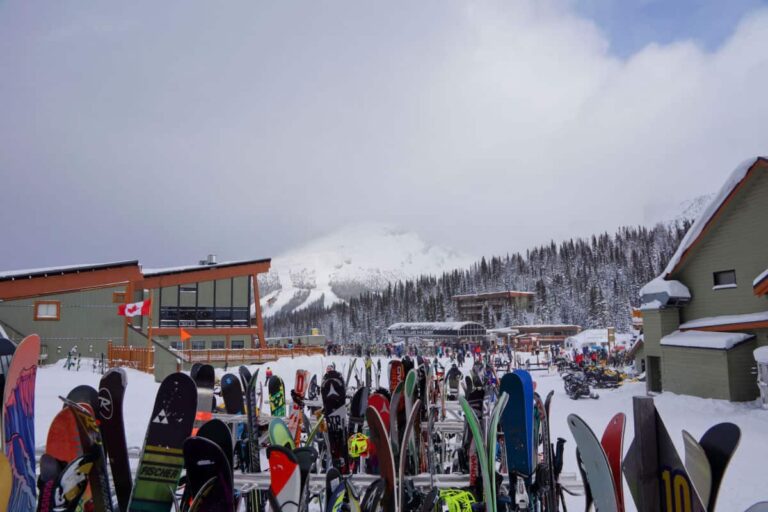
8. SULPHUR MOUNTAIN
Sulphur Mountain provides you with a view over the Bow Valley and the town of Banff. The 2,451 meters (8,041 foot) high mountain was named for the hot springs located on its flanks. Sulphur Mountain is home to several tourist attractions. Most important: beautiful views of Banff with Cascade Mountain rising above Banff Avenue are guaranteed.

A. Banff Gondola
The Banff Gondola takes you from the valley to the top of the mountain in about eight minutes. From there, you’ll have a stunning view of Banff, the mountainous surroundings and the Bow River winding through the Bow Valley. Once at the top, you can visit two restaurants (Sky Bistro, Northern Lights/Peak Patio), the Banff Upper Gondola souvenir store and some observation decks.
TIP: Those who hike to the top via the well-worn path on the flanks of Sulphur Mountain can take a free ride back down from 7 pm.
Location: 51°07′25″N 115°33′21″W
CONTACT
Sky Bistro: +1 403 – 762 7475
Northern Lights/Peak Patio: +1 866 – 756 1904
B. Banff Upper Hot Springs
Those who want to relax in a healthy way overlooking the majestic flanks of Mount Rundle do well in visiting the Banff Upper Hot Springs. The hot spring at this site was discovered in 1883 by Canadian Pacific Railway employees. It was this discovery that led to the development of Banff National Park.
It is the highest hot spring in Canada at 1585 meters (5200 feet). The hot mineral water emerges from a fissure on the flank of Sulphur Mountain called the Sulphur Mountain Thrust Fault. The pool’s water temperature filled with this water is a whopping 38 degrees Celsius (100 degrees Fahrenheit).
Address: 1 Mountain Ave, Banff
Contact: +1 800 – 767 1611
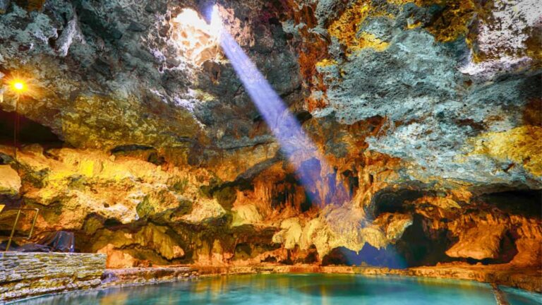
C. Cave and Basin National Historic Site
Way down on the flanks of Sulphur Mountain (1405 meters/4610 feet), you’ll find Cave and Basin, the lowest elevation of the nine sulfurous hot springs on Sulphur Mountain. Cave and Basin are situated on the northeast flank of the mountain. The water that emerges from the mountain is geothermally heated at an estimated depth of 3,000 meters (9842 feet).
A bathhouse was built on this site in 1887. This proved inadequate in 1902, after which a new pool was built in 1904. Today, you’ll find a replica of the original bathhouse at this location. Furthermore, you’ll find the pool building constructed in 1914. The pool was closed and reopened several times over the years until it was closed permanently in 1994. Now there’s an interpretation center at the site of the old pool.
From the entrance building you have access to a complex of wooden boardwalks that lead you past all kinds of unique and fragile nature – such as the endangered Banff Springs snail – that could arise due to the warm mineral water. You also have access to the cave from here. Since 1981, the Cave and Basin have been a national historic site.
Address: 311 Cave Ave, Banff
Contact: +1 403 – 762 1566
D. Sulphur Mountain Weather Station
Sulphur Mountain is also known for its weather station. The modest little building was built at the top of the mountain in 1902 and constructed of local materials. It served as a shelter for meteorologists and the measuring equipment.
The data gathered there over the years played an essential role in determining the climate of the Rocky Mountains. The weather station was part of government efforts to boost tourism in Banff and provide the public with weather information.
The weather station, also known as Sulphur Mountain Observatory, has been recognized as a federal heritage site. The iconic little building is easily accessible via an extensive stair system at the top of the mountain.
Location: 51°08′41″N 115°34′33″W
7. BOW LAKE
Bow Lake is one of the must-see stops on the Icefields Parkway. The glacial lake is located 38 kilometers from Lake Louise on the left side of the road when coming from Lake Louise.

Bow Lake is located at an elevation of 1920 meters (6300 feet). The lake is the origin of the Bow River. From the edge of the lake, you have a magnificent view on the massive Bow Glacier and the Wapta Icefield.
Right off the highway, you can see the Num-Ti-Jah Lodge nestled among the trees. The lodge is a large wooden building with a red roof on the right side of the lake. In the lodge, you can get coffee, tea, soft drinks and all kinds of snacks. Spending the night there is also possible.
You can take hiking trips to all kinds of beautiful destinations from the lodge, such as the Bow Hut, Crowfoot Mountain, and Glacier Lake.
Location: 51°39′52″N 116°26′55″W
6. VERMILION LAKES
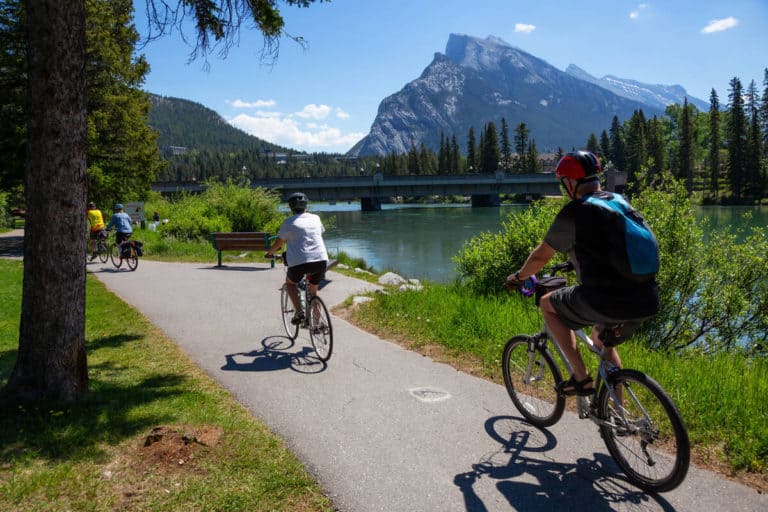
Vermilion Lakes comprises three lakes immediately west of Banff. On the horizon eastward, the jagged contours of Rundle Mountain and Sulphur Mountain dominate the skyline. Here you are within walking distance of Banff, but you can almost imagine yourself in an uninhabited world. Almost, because right behind you, you hear the roar of cars on the Trans-Canada Highway.

The lakes are easily accessible via the Vermilion Lakes Road, directly under the Trans-Canada Highway. It begins at the turnoff to Banff off Mount Norquay. This dead-end road is accessible by car. At the end you can easily turn around. Along the road there is ample opportunity to take beautiful pictures. And of course you can do a walk along the lakes. Or hike the Legacy Trail that begins at the end of the road.
Location: 51.1808° N, 115.5942° W
5. LAKE LOUISE
Lake Louise is number one in many lists because of the turquoise color of the glacial lake so picturesquely sandwiched between the Rockies, with the imposing Victoria Glacier in the background. A beautiful picture indeed. That’s why Lake Louise ranks high in this review.

The lake is located five kilometers (3.10 miles) from the hamlet of the same name and the Trans-Canada Highway (Highway 1). It was named after Princess Louise Caroline Alberta, Queen Victoria’s fourth daughter.
This is a super-touristy place which is made clear by the vast Fairmont Château Lake Louise hotel on the edge of the lake. The hotel has no less than 539 rooms. From the hotel, you can undertake various hikes. You can walk around the lake and walk to the glacier, Lake Agnes and the Plain of Six Glaciers.
The significant number of tourists visiting Lake Louise in the high season can be overwhelming. In the busiest months the spacious parking lot is nowhere near sufficient. That means you have to park your car in a parking lot further down the road and then take a shuttle bus to the lake. It’s a bit cumbersome, but the reward is a must-see in Banff National Park.
Location: 51°24′42″N 116°13′41″W
4. JOHNSTON CANYON
At 17 kilometers (10.5 miles) from Banff, you’ll find Johnston Canyon. This is a breathtaking canyon that includes waterfalls and the so-called ink pots, five green-blue mineral water springs you’ll find on your trip through the canyon. This is one of the most touristy locations in the park, and it is also accessible for children. So be prepared for crowds of people. Or arrive early so you can stay ahead of the masses.

The hike through the canyon is 5.6 km (3.47 miles) long and takes two to three hours. For those who want to walk less, the short route to the Lower Falls is just under 2.5 kilometers (1.55 miles) long. Johnston Canyon can be reached via the Bow Valley Parkway.
Address: Bow Valley Parkway, Improvement District No. 9
Contact: +1 403 – 762 1550
3. PEYTO LAKE
Peyto Lake is a must-see for those driving down the Icefields Parkway between Lake Louise and Jasper. The glacial lake is just as beautiful as Lake Louise and Moraine Lake. It owes its turquoise-green color to the glacier sludge, which ends up in the lake via the melting water of the glacier. The sunlight reflects off of it giving the lake its outstanding color.

Peyto Lake was named after ‘Wild’ Bill Peyto, pioneer and mountain guide and a park superintendent in Banff National Park in the early twentieth century. The lake, located at an elevation of 1610 meters (6100 feet) has a distinctive shape: the north side of the lake resembles a fox’s head.
A short hike takes you from the parking lot to the overlook on Bow Summit. From there, you can overlook the lake. Again, you can count on lots of tourists, which often makes it challenging to take a picture of the lake without (other) people on it. But again, the lake is a must-see.
Location: 51°43′37″N 116°31′19″W
2. MORAINE LAKE
Moraine Lake at number two is perhaps a somewhat personal choice. Nearby Lake Louise is even more famous and is often called the most beautiful natural phenomenon in Banff National Park.

But Moraine Lake – located at 1884 meters (6181 feet), definitely has its own undeniable charm. In addition to the familiar turquoise-blue color that characterizes so many lakes in Banff National Park, it is located in the scenic Valley of the Ten Peaks. Not for nothing did the beautiful view grace the twenty Canadian dollar bill the 1969 and 1979 issues.
Moraine Lake is located 14 kilometers (8.6 miles) outside Lake Louise Village, at the end of Moraine Lake Road. Because the lake is usually very busy during peak season, the local parking lot fills up very quickly. At the Park and Ride parking lot on the Trans-Canada Highway near Lake Louise Village, a shuttle bus goes to Moraine Lake every twenty minutes between 8:10 am and 5:30 pm.
As with any lake in the park, you can do hikes all around it, such as the Louise Creek Trail and the Bow River Loop. And what about a canoe trip on the lake? You can rent a canoe on-site.
Moraine Lake is not open year-round. Due to snowfall and avalanche danger, the road to the lake is closed between mid-September, October and mid-June.
Location: 51°19′21″N 116°11′08″W
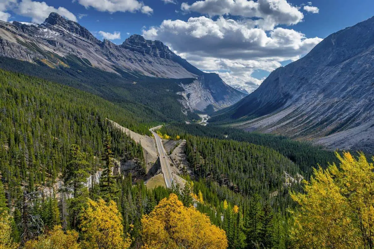
1. ICEFIELDS PARKWAY (HIGHWAY 93 N)
How can a road be number one? Of course, it’s not about the strip of asphalt through the Rocky Mountains, but rather the incredible, natural beauty along the road which leads from Lake Louise Village to Jasper.

The Icefields Parkway (Highway 93 N) has been called one of the most beautiful roads in the world, and for a good reason. You trade one dream view for another at every turn. You drive past countless viewpoints, lakes, glaciers, waterfalls, creeks and rivers. To name a few: Bow Lake, Hector Lake, Peyto Lake, Athabasca Falls and Sunwapta Falls. And if you’re lucky you’ll also run into a bear or two, three. Or a moose. Or a caribou.
As for an encounter with wildlife: make sure you get in your car early, very early (say 5:30 am). Then the road is still virtually deserted, and you have the best chance of greeting local wildlife. If you drive the route later in the day, be warned if you suddenly see cars parked along the road. Chances are that a bear or other (large) animal is walking there.
The Icefields Parkway is an aptly chosen name. It runs along the Wapta and Columbia Icefield, the largest icefield in North America. Several glaciers converge here, such as the Columbia and Athabasca glaciers.
The latter can be seen in all its glory from the Icefields Parkway. Park your car for a while. You can do a short hike to the foot of the glacier. Dress warmly because the wind blows hard, and it can be cold, even in mid-summer.
For an even better experience book a seat on the snow coach: this is a special bus suitable for the glacier. Book in time because a ride on the glacier is extremely popular.
A little further north, you can walk around the Glacier Skywalk, the 35-metre long glass floor above the Supwapta Valley. From there, you have a magnificent view of the Columbia Icefield.
Location: 52.1897° N 117.2578° W (Icefields Parkway (Highway 93 N) between Lake Louise Village and Jasper)