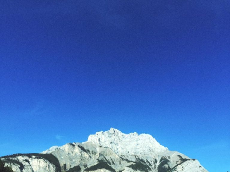
Banff’s 14 Easy-to-Reach Lakes You Must See
Banff National Park owes its stunning scenery for a large part to the turquoise-colored lakes, so during your visit, you’ll want to visit several. To make things easy for you, I listed the most beautiful and easily accessible lakes in the park.
This post includes:
- Descriptions of 14 notable lakes in Banff National Park
- The nearest campgrounds to each lake, the local parking options and whether or not there are restrooms on-site
- Geological data on each lake
- A map indicating all lakes on this list
- A distance chart indicating the distances between the town of Banff and the village of Lake Louise and the lakes
- An illustration showing how the lakes’ altitudes and sizes vary
Bow Lake

Bow Lake is 38 kilometers from Lake Louise Village and is the third lake on the Icefields Parkway (after Herbert and Hector Lake). At the lake, you can view the Wapta Icefield, Bow Glacier, Bow Peak, Mount Thompson, Crowfoot Glacier, and Crowfoot Mountain. It is located south of Bow Summit and east of the Waputik Range. Bow lake is situated west of Cirque Peak, Dolomite Peak, and Dolomite Pass.
Bow Lake is also home to the historic Num-Ti-Jah Lodge. Built in the 1930s by famed outdoorsman Jimmy Simpson, the Num-ti-Jah lodge is a rustic cabin that sits on the shores of Bow Lake. It’s a popular destination for visitors to the area and offers accommodations, meals, and guided tours.
Like most lakes in the park, Bow Lake is a great place to engage in various outdoor activities. The area is home to many hiking trails, ranging from strolls to challenging backcountry routes.
Surface elevation: 1,920 m (6,299 ft)
Area: 3.21 km2 (1.24 sq mi)
Getting There
Bow Lake is 38 kilometers north of Lake Louise, on the left side of the Icefields Parkway. You can’t miss it.
Parking
There is a lakefront parking lot next to the Icefields Parkway. Even though it’s typically crowded in the summer, you should be able to find a spot.
Nearest Campgrounds
- Silverhorn Creek Campground (17 km / 10.5 mi)
- Lake Louise Campground (38 km / 23.6 mi)
Toilets
The parking area at Bow Lake off the Icefields Parkway lacks an outhouse. However, there are restrooms in the restaurant of the Num-Ti-Jah-Lodge.
Cascade Ponds

Cascade Ponds is a collection of three relatively shallow bodies of water close to each other, located at the foot of Cascade Mountain. The middle one is the largest and has some nice picnic and barbecue options and a shelter.
Cascade Ponds’ relatively short depth allows the water to warm to a comfortable temperature in the summer. In contrast to most of the park’s very frigid lakes, swimming is possible here.
One of the most convenient aspects of Cascade Ponds is that it’s close to the town of Banff. Situated just a few kilometers east of Banff, the ponds are easily accessible. You can get there by car or bike. A paved road leads up to the ponds.
Cascade Ponds is also a great place to engage in various outdoor activities. The area is home to many hiking trails, ranging from easy strolls to challenging backcountry routes. Several campsites are also located near the ponds, making it an excellent place for overnight stays.
The area is home to various wildlife, including bighorn sheep, elk, and bears, making it an excellent place for wildlife viewing.
Surface elevation: 1,518 m (4,980 ft)
Area: –
Getting There
After passing the Trans-Canada Highway viaduct on Banff Avenue heading northeast, take the first exit on the right.
Parking
There is a spacious parking lot near the ponds.
Nearest Campgrounds
- Tunnel Mountain Village Campground (4.7 km / 2.9 mi)
- Two Jack Lake Main Campground (6.5 km / 4 mi)
- Two Jack Lakeside Campground (5.8 km / 3.6 mi)
Toilets
Flushing outhouse
Glacier Lake

Glacier Lake is one of the many beautiful lakes along the Icefields Parkway. It got its name from the glaciers of the Lyell and Mons Icefields and the Forbes North Glacier that feed the lake. Sir James Hector of the Palliser expedition named it in 1858.
Located relatively close to the Saskatchewan River Crossing, you can reach Glacier Lake by hiking the 8.9-kilometer (5.5 mi) Glacier Lake Trail, which leads directly to the lake. It’s a relatively easy trail with a modest elevation gain of 238 meters (781 ft).
Surface elevation: 1,480 m (4,856 ft)
Area: 2.51 km2 (0.97 sq mi)
Getting There
Drive the Icefields Parkway to the Glacier Lake turn-off, 1 kilometer (0.62 mi) west of the Saskatchewan River Crossing.
Parking
At the Glacier Lake trailhead at the end of a short gravel road about 1 kilometer (0.62 mi) west of the Saskatchewan River Crossing.
Nearest Campgrounds
- Glacier Lake Campground (backcountry, 8.9 km / 5.5 mi)
- Rampart Creek Campground (12.2 km / 13.34 mi)
- Thompson Creek Campground (10.5 km / 6.5 mi)
Toilets
There’s an outhouse at the Glacier Lake campground.
Hector Lake

Hector Lake is a beautiful and popular destination along the Icefields Parkway. The lake is named after James Hector, a Scottish geologist of the Palliser Expedition, that explored and surveyed western Canada’s open plains and wilderness from 1857 to 1860.
There is a viewpoint just off the Icefields Parkway. You can also hike the Hector Lake Trail to the lakeshore. It’s an easy to moderate 4.5-kilometer (2.8 mi) hike (out and back) that takes about 1.5 hours to complete. Be aware that this trail involves a river ford, so take an extra pair of (sturdy) shoes.
Fishing is also popular at Hector Lake, with various fish species such as rainbow trout, brook trout, and cutthroat trout found in the lake. A valid Alberta fishing license and a Banff park pass are required to fish in the lake.
Surface elevation: 1,800 m (5,906 ft)
Area: 5.23 km2 (2.02 sq mi)
Getting There
Hector Lake is close to the Icefields Parkway, 23 km (14 mi) north of Lake Louise.
Parking
There’s a parking lot on the left side of the Icefields Parkway (coming from the direction of Lake Louise). It’s a small dirt pull-out.
Nearest Campgrounds
- Kicking Horse Campground ( 37 km / 23 mi)
- Lake Louise Campground (22.6 km / 14 mi)
Toilets
There are no restroom facilities at Hector Lake.
Herbert Lake

Herbert Lake is located just off the Icefields Parkway, making it an easy stop if you’re touring the area. In addition to its convenient location, Herbert Lake is also a great place to go hiking. Nearby trails range from strolls to challenging backcountry routes.
The lake is not too deep, allowing the lake water to warm up better in the summer than most other lakes in the park. It doesn’t automatically imply that the water will reach a pleasant temperature.
For many people, it’s still stone cold, so do not expect too much of it. To go swimming in the lake, you must walk a little down from the Icefields Parkway parking lot. The lake has no sandy beach, but it does have a diving board.
Several campsites are located near the lake, making it an excellent place in the park for overnight stays.
Surface elevation: 1,607 m (5,272 ft)
Area: –
Getting There
Herbert Lake is only 5.7 km (3.5 mi) north of the hamlet of Lake Louise. It’s located right off the Icefields Parkway on your lefthand side.
Parking
There is a pretty spacious parking lot close to the Icefields Parkway.
Nearest Campgrounds
- Lake Louise Campground (6.8 km / 4.2 mi)
- Protection Mountain Campground (21 km / 13 mi)
- Kicking Horse Campground (21.1 km / 13.1 mi)
Toilets
There is a flushing outhouse at the Herbert Lake parking area.
Johnson Lake

Johnson Lake is a beautiful, serene little lake just a few kilometers east of Banff. It’s easily accessible from the town, and you can reach it by bike or car. It’s an excellent place for picnicking, with lots of picnic tables.
Like nearby Cascade Ponds, Johnson Lake is relatively shallow, allowing for some nice summer splashing, like swimming, kayaking or stand-up paddleboarding (SUP).
In addition, Johnson Lake has a sandy beach (larger than the one at Cascade Ponds). There’s also a section where you can wade through the water.
Families with (young) children who enjoy camping will especially benefit from this lake and the surrounding area. There are three well-equipped campgrounds within an 11-kilometer (6.8 mi) radius, and Johnson Lake is one of the few lakes warm enough for swimming.
The area is home to several hiking trails, ranging from strolls to challenging backcountry routes. The site is also home to various wildlife, including bighorn sheep, elk, and bears, making it an excellent place for wildlife viewing.
Surface elevation: 1,426 m (4,678 ft)
Area: 0.20 km2 (0.07 sq mi)
Getting There
Johnson Lake is straightforward to find. After passing the Trans-Canada Highway viaduct on Banff Avenue heading northeast, take the second exit on the right. After about four kilometers, you’ll see a turn-off on your right side. It leads you straight to the lake.
Parking
There’s a pretty sizeable parking lot near the lakeshore. However, the parking lot may quickly fill up on weekends and holidays, so get there early to ensure a parking space.
Nearest Campgrounds
- Two Jack Main Campground (3.5 km / 2.2 mi)
- Two Jack Lakeside Campground (4.2 km / 2.6 mi)
- Tunnel Mountain Village Campground (11 km / 6.8 mi)
Toilets
There is a building with four toilets in the Johnson Lake parking area.
Lake Agnes

Lake Agnes is a beautiful, small lake in the mountains above Lake Louise. It provides a stunning view of the Continental Divide, the primary hydrological and mountainous division of the Americas.
One of the most interesting aspects of Lake Agnes is the nearby tea hut. Located on the lake’s eastern shore, the Lake Agnes Tea House is a small wooden hut serving visitors hot drinks and light meals.
The tea house is only accessible by foot, and you can reach it via a moderate hike from Lake Louise. The hike there is relatively short but steep in parts and can be challenging.
The area is home to several hiking trails, like the Beehive, a continuation of the hike to Lake Agnes.
Surface elevation: 2,135 m (7,005 ft)
Area: 0.52 km2 (0.2 sq mi)
Getting There
Get to the Fairmont Château Lake Louise. You can get there by car (if you arrive at the lake very early) or by shuttle bus. The trailhead is in front of the hotel, then hike up the mountain following the Lake Agnes Trail.
Parking
You can park at the Lake Louise car park. However, you must arrive early to guarantee a parking spot at the lake. By early, I’m talking about between 6 am. Not kidding.
If you come after 7 am, you’ll almost certainly need to park your car at the Lake Louise overflow and take the shuttle bus to the lake.
Nearest Campgrounds
- Lake Louise Campground (4.5 km / 2.8 mi)
- Kicking Horse Campground (19.5 km / 12.1 mi)
Toilets
There’s a public washroom in the parking lot. Additionally, restrooms are available at the Lake Agnes Tea House and the Fairmont Château Lake Louise.
Lake Louise

Nestled among the Rocky Mountains, the turquoise-colored Lake Louise is a must-visit for anyone looking to experience the natural beauty of the Canadian wilderness.
The lake, named after Princess Louise Caroline Alberta, the fourth daughter of Queen Victoria, is a sight to behold. The water is a mesmerizing shade of turquoise caused by the rock flour (finely ground rock particles) suspended in the water. Towering peaks surround the lake, and the Victoria Glacier looms above at the other end of the lake.
Whether you’re admiring the view from the shores of the lake or taking a stroll along the trails that wind through the surrounding wilderness, Lake Louise is a nature lover’s paradise.
But Lake Louise isn’t just a pretty face; it’s also an excellent place for outdoor activities. You can go hiking, mountain biking, horseback riding, and fishing in the summer.
In the winter, the lake transforms into a winter wonderland, offering opportunities for cross-country skiing, snowshoeing, and ice skating. No matter what time of year you visit, there’s always something to do at Lake Louise.
Furthermore, Lake Louise stands out from most other lakes in the park thanks to the rich history of its illustrious Fairmont Château Lake Louise hotel. No wonder the lake has been a popular tourist destination for over a century.
Surface elevation: 1,600 m (5,249 ft)
Area: 0.90 km2 (0.35 sq mi)
Getting There
Take the exit Lake Louise on the Trans-Canada Highway 1 and follows the signs to the lake.
Parking
You can park at the Lake Louise car park. However, you must arrive early to guarantee a parking spot at the lake. Early means around 6 am. Seriously.
Nearest Campgrounds
- Lake Louise campground (4.5 km 2.8 km)
- Kicking Horse Campground (19.5 km / 12.1 mi)
Toilets
There’s a public washroom in the parking lot. The Fairmont Château Lake Louise also has restrooms.
Lake Minnewanka

Lake Minnewanka, just a few kilometers east of Banff, is the biggest lake in Banff National Park. One of the most unique and exciting aspects of this significant body of water is the submerged remains of the former resort town of Minnewanka Landing.
Located at the south end of the lake, Minnewanka Landing was a small community established in the late 1800s and home to a hotel, a general store, several other businesses and houses, of course.
At its peak, Minnewanka Landing was a popular destination for tourists and locals alike, and it played a significant role in the early development of Banff National Park.
However, in the early 1900s, the Canadian Pacific Railway decided to dam the lake to generate hydroelectric power. The resulting rise in water levels caused the town of Minnewanka Landing to be submerged, and it has remained underwater ever since. Today, the remains of the old community are a divers’ paradise as they can explore a submerged ghost town.
Lake Minnewanka isn’t just a place with a rich history; it’s also a great place to engage in various outdoor activities. You can enjoy fishing, hiking, and mountain biking in the summer. As Lake Minnewanka is the only lake in the park that allows motorized boats, you can also go on a boat excursion. Several lake cruises are available.
Furthermore, near the parking lot there are several picnic tables.
The lake’s surroundings offer winter cross-country skiing, snowshoeing, and ice skating opportunities.
Surface elevation: 1,500 m (4,900 ft)
Area: 22 km2 (8.49 sq mi)
Getting There
After passing the Trans-Canada Highway viaduct on Banff Avenue heading northeast, keep following the road (Lake Minnewanka Scenic Drive). It will take you right to the lake shore.
Parking
You’ll eventually arrive at the lakeshore after driving from Banff Avenue onto Lake Minnewanka Scenic Drive. Just before it, on your left, is a sizable parking area.
Nearest Campgrounds
- Two Jack Lake Main Campground (3.4 km / 2.11 mi)
- Two Jack Lakeside Campground (3.8 km / 2.36 mi)
- Tunnel Mountain Village Campground (13.6 km / 8.5 mi)
Toilets
The parking lot area has restroom facilities.
Moraine Lake

This stunning lake, which, in my opinion, easily rivals Lake Louise in beauty, is situated in the Valley of the Ten Peaks, creating a picturesque setting that will take your breath away.
Like most glacier lakes in the park, the water is a mesmerizing shade of blue caused by the rock flour (finely ground rock particles) suspended in the water.
The color of the lake changes throughout the day, ranging from a deep blue in the morning to a bright turquoise in the afternoon. Whether you’re admiring the view from the shores of the lake or taking a stroll along the trails that wind through the surrounding wilderness, Moraine Lake is of an almost surreal beauty.
If you want a stunning view of the lake and the valley, climb the big rock pile near the parking lot at the lake’s northeastern shore. The pile is pretty high, allowing for a stunning perspective.
Just like Lake Louise and most other lakes in this overview, Moraine Lake is also great for outdoor activities like hiking, mountain biking and fishing in the summer.
In the winter, the lake transforms into a winter wonderland, offering opportunities for cross-country skiing, snowshoeing, and ice skating. However, the road to lake Moraine is closed to cars in winter due to avalanche risk. It requires much more effort to get there.
Surface elevation: 1,884 m (6,181 ft)
Area: 0.5 km2 (0.19 sq mi)
Getting There
Take Lake Louise Drive off the Trans-Canada Highway at the exit for Lake Louise. Take a left turn onto Moraine Lake Road at the intersection.
Parking
If you think parking at Lake Louise is difficult, parking at Moraine Lake is even more difficult. There is lakeside parking, but you must arrive very early to obtain a spot because it fills up quickly. I’m talking here about arriving at 5 am.
Nearest Campgrounds
- Lake Louise Campground (14.7 km / 9.1 mi)
- Protection Mountain Campground (29.5 km / 18.3 mi)
Toilets
There are restrooms at the lakeshore parking lot. These are so-called drop toilets (no flush) and don’t smell very nice, to put it mildly. Additionally, the cafe next to the Moraine Lake Lodge has washrooms.
Peyto Lake

Peyto Lake is the third most visited lake in Banff National Park – after Moraine Lake and Lake Louise – and a must-visit for anyone looking to experience the natural beauty of the Canadian wilderness.
In Peyto Lake, rock flour also causes the striking turquoise water for which Canadian Rockies are famous.
The lake was named after Ebenezer William (Bill) Peyto (1869-1943), a hiking guide and poacher who lived in Banff. Peyto Lake was opened to tourists in 1941.
It is located on the Icefields Parkway (Highway 93 N), 100 kilometers (62 mi) north of Banff and 44 kilometers (27 mi) north of Lake Louise Village. It’s easily accessible by car, and there are two car parks at the site. The second one is higher up and is only accessible for buses, seniors and people with disabilities.
Both parking areas provide access to the Peyto Lake Lookout, which offers a breathtaking vantage point from which to view the lake. Due to the lake’s popularity, expect numerous tourists at the lookout.
Surface elevation: 1,860 m (6,102 ft)
Area: 1.4 km2 (0.54 sq mi)
Getting There
Peyto Lake is situated just off the Trans-Canada Highway (Highway 1). Take the exit indicating Peyto Lake and park at the parking lot close to the highway. The lake is only a short hike away.
Parking
There is a sizable parking lot at the lake with room for 126 cars and 11 RVs. Even though it might get swamped in the summer, you should be able to find a parking spot.
Nearest Campgrounds
- Silverhorn Creek Campground (10.2 km / 6.3 mi)
- Waterfowl Lakes Campground (15.9 km / 9.8 mi)
Toilets
There is a small toilet building in the parking lot.
Two Jack Lake

Two Jack Lake is a kind of offshoot of Lake Minnewanka, as the two lakes are connected. It is fed by the Cascade River, which originates from the neighboring Cascade Mountain, the mountain that rises above Banff in the north.
Two Jack Lake, close to Banff, provides a breathtaking vista of Mount Rundle when facing south. And in the evening, the lake is an excellent location for stargazing.
The Cascade River’s water enters the lake through Stewart Canyon. East of the lake, on Mount Inglismaldie, Mount Girouard, and Mount Peechee, are numerous more streams that feed the lake.
Especially in high season, it can be crowded on and around Two Jack Lake as there are usually many kayakers. Two Jack Lake is a great camping spot as two campgrounds are situated on the shore.
One of Two Jack Lake’s most interesting aspects is its name’s origin. The lake is named after two Irishmen, Jack Burns and Jack Neal, who were early pioneers in the Banff area.
Burns and Neal operated a sawmill near the lake and were instrumental in the region’s development. The lake was named in honor of these two men and has been known as Two Jack Lake ever since.
Surface elevation: 1,375 m (4,511 ft)
Area: 0.21 km2 (0.08 sq mi)
Getting There
After passing the Trans-Canada Highway viaduct on Banff Avenue heading northeast, take the second exit on the right. Keep following the road. After 5.8 kilometers (3.6 mi), you’ll arrive at the lake.
Parking
There are two small parking lots at the lake. One is situated at the lakeshore; the other is a bit higher up. Arrive early if you want to secure a parking spot. Both parking lots fill up quickly in summer.
Nearest Campgrounds
- Two Jack Lake Main Campground (750 m / 820 yards)
- Two Jack Lakeside Campground (1.1 km / 0.68 mi)
Toilets
There are some drop toilets near the lake.
Vermilion Lakes

Vermillion Lakes is an interesting collection of lakes. Not only is it stunningly beautiful, but it’s also within walking distance of the town of Banff. Yet, it’s never bustling, not even in the middle of summer.
Located just a few kilometers west of Banff, Vermilion Lakes is easily accessible from the town.
Vermilion Lakes is a beautiful location to unwind and take in the natural beauty of the surroundings. The lakes’ jetties are ideal for quiet reflection, admiring the breathtaking scenery with Mount Rundle in the background, or having a picnic.
If you want to admire the lakes and their surroundings from the water, you can kayak there from the Bow River in Banff or use a stand-up paddleboard (SUP).
The site is also home to various wildlife, including bighorn sheep, elk, and bears, making it an excellent place for wildlife viewing.
Also good to know: You can hike the Fenland Trail close to Vermilion Lakes. It’s an easy walk through the woods that, now and then, provides a glimpse of the surroundings through the thicket.
Surface elevation: 1,378 m (4,521 ft)
Area: 0.48 km2 (0.19 sq mi)
Getting There
You can reach Vermilion Lakes from the Trans-Canada Highway by turning onto Mount Norquay road at the western crossroads close to Banff. Soon after this intersection, you turn onto Vermilion Lakes Road. It’s on your right. If you’re coming from the town of Banff, the road is on your left, about 350 meters after the train tracks.
Parking
Vermilion Lakes lacks a designated parking area. However, you should be able to park on the side of the road. Usually, there’s ample space to park.
Nearest Campgrounds
- Tunnel Mountain Village Campground (10 km / 6.2 mi)
Toilets
There are no restroom facilities at Vermilion Lakes.
Waterfowl Lakes

Waterfowl Lakes is located just off the Icefields Parkway, 16 kilometers (10 mi) north of the famous Peyto Lake, making it an easy stop if you’re touring the area. A viewpoint offers stunning views of the surroundings, notably White Pyramid mountain, which is 3,219 meters (10,561 ft) high.
In addition to its convenient location, Waterfowl Lakes is also a great place to engage in various outdoor activities. The area is home to several hiking trails, ranging from strolls to challenging backcountry routes. And nearby Chephren Lake (you can hike there) offers even more opportunities.
And then there’s the Waterfowl Lakes campground, nestled between the two lakes, making it an excellent place for overnight stays.
The area is also home to wildlife, including bighorn sheep, elk, and bears, making it an excellent place for wildlife viewing.
Getting There
Waterfowl Lakes is easy to find as it’s just off the Icefields Parkway, indicated by signs.
Parking
You can park in the pull-out beside the road.
Nearest Campgrounds
- Waterfowl Lakes Campground (at the very location)
Toilet
The viewpoint doesn’t have any washroom facilities. At the nearby campground, however, there are three dry toilets and one flush toilet.
Surface elevation: 1,680 m (5,512 ft)
Area: –
Lakes Map
Below, you’ll find all listed lakes (14) on a map. This way, you can easily understand where to find them. Combine it with the distances mentioned below, and you can quickly make an itinerary to (some) of the lakes on this list.
Charts
Below, you’ll find two charts. The first indicates the elevation of the lakes, the other one shows the relative size of all the lakes. The last chart lacks Cascade Ponds, Herbert Lake, and Waterfowl Lakes as I couldn’t find any trustworthy data for these lakes.


Tips for Visiting Banff National Park’s Lakes
Here’s a comprehensive list of tips for visiting the lakes of Banff National Park:
- Best Times to Visit: The best time to visit Banff National Park’s lakes is during the summer months, from June to September, when the weather is warm and the lakes are thawed. However, this is also the busiest time of year, so be prepared for crowds.
- Parking: Parking can be limited at the more popular lakes, like Lake Louise and Peyto Lake. This is especially true during peak tourist season. Arrive (very) early in the morning or later in the evening to avoid crowds and increase your chances of finding a parking spot. Consider taking public transportation or carpooling to reduce traffic and parking congestion.
- Hiking: Many of Banff National Park’s lakes are accessible by hiking trails, which can offer stunning views and a more immersive experience in nature. Be sure to wear appropriate footwear and bring plenty of water and snacks.
- Wildlife: Banff National Park is home to a variety of wildlife, including bears, elk, and moose. Be sure to keep a safe distance from any animals you encounter and never feed them. Always carry bear spray and know how to use it in case of an encounter.
- Boating: Many of Banff National Park’s lakes offer boating opportunities, including canoeing, kayaking, and paddleboarding.
- Swimming: Swimming is allowed at the lakes in Banff National Park, but be aware that the water in most of them is much too cold for swimming as most lakes are glacially fed.
- Photography: Banff National Park’s lakes offer stunning photo opportunities, especially during sunrise and sunset.
- Leave No Trace: Banff National Park’s lakes are part of a vulnerable ecosystem, so keep them clean and pristine. Always pack in what you pack out and dispose of trash properly.
- Weather: The weather in Banff National Park can change quickly, so be prepared for all conditions. Bring layers, sunscreen, and a hat to protect yourself from the sun.
- Plan Ahead: Banff National Park’s lakes are a popular destination, so plan ahead and book accommodations and activities in advance. Check park websites for up-to-date information and always follow posted signs and regulations.
Distances Table
Below you’ll find the distances from the town of Banff and the village of Lake Louise to all fourteen lakes described in this post.
| LAKE | BANFF | LAKE LOUISE |
|---|---|---|
| Bow Lake | 101 km (63 mi) | 39 km (24 mi) |
| Cascade Ponds | 5 km (3 mi) | 61 km (39 mi) |
| Glacier Lake* | 144 km (89 mi) | 82 km (51 mi) |
| Hector Lake | 85 km (53 mi) | 23 km (14 mi) |
| Herbert Lake | 70 km (43 mi) | 7.3 (4.54 mi) |
| Johnson Lake | 11.4 km (7.08 mi) | 68 km (42 mi) |
| Lake Agnes* | 68 km (42 mi) | 4.4 km (2.73 mi) |
| Lake Louise | 68 km (42 mi) | 4.4 km (2.73 mi) |
| Lake Minnewanka | 14 km (9 mi) | 70 km (44 mi) |
| Moraine Lake | 79 km (49 mi) | 14 km (9 mi) |
| Peyto Lake* | 108 (67 mi) | 46 km (29 mi) |
| Two Jack Lake | 11.4 (7.08 mi) | 68 km (42 mi) |
| Vermilion Lakes | 3.5 km (2.17 mi) | 59 km (37 mi) |
| Waterfowl Lakes | 124 km (77 mi) | 62 km (39 mi) |
* The distance to the car park.
Banff Travel Guide and FAQ
Where is Banff National Park, Canada?
Banff National Park is in the southwest of the province of Alberta. It’s home to the towns of Banff and Lake Louise and borders the province of British Columbia in the west of Canada. You can easily access famous places like Lake Louise, Moraine Lake, Peyto Lake and the stunning Icefields Parkway from these locations.
Banff and Lake Louise are situated in the Rocky Mountains of Alberta, close to the boundary with British Columbia, as shown on the map of Banff National Park below.https://www.google.com/maps/d/embed?mid=1NZLFEGL3tedVaH8sRqHo3U37urB0dY4&ehbc=2E312F
Is Banff, Canada safe?
Generally speaking, yes. Like most areas, Banff has crime, but it’s still a safe travel place. But Banff has a lot of wildlife, including bears and cougars, so you should always carry bear spray and exercise caution when hiking in the mountains.
What is the best time to Travel to Banff, Canada?
The best time to travel to Banff, Canada, depends on your reason for visiting the park. If you’re going for the stunning nature the park’s famous for, you’d better visit from June to September. The best months to ski are from January through March.
WEATHER IN BANFF, CANADA: AVERAGE TEMPERATURE

The worst months to visit Banff National Park are November, April and May. It’s too chilly to go sightseeing in November, and there isn’t enough snow on the slopes yet. The iconic lakes in the park are still frozen in April and May, and it can still be quite cold.
How do I travel to Banff, Canada?
Want to fly to Banff? Calgary International Airport (Code: YYC) is the closest airport. It’s 130 kilometers (81 mi) to the east of Banff.
Several cities, including Toronto, Chicago, Seattle, and Dallas/Fort Worth, have direct flights into Calgary.
Pick up a rental vehicle at Calgary International Airport, or take a private transport service to your destination. The trip to the park takes about 1 hour and 40 minutes.
Viator has several good options. Click the link to check the options and latest rates.
Banff Car Rental
Want to rent a car during your stay in Banff National Park? Rent one at Calgary International Airport or in the city of Calgary. Yep, there are rental firms in Lake Louise and Banff, but as these are small towns, your rental options can be limited.
Avis is a reputable car rental company, which I’ve used many times. Book now with Avis
What do I pack for Banff, Canada?
The time of year will affect what you should bring with you on your trip to Banff, Canada. If you plan to spend your summer vacation in Banff National Park, you should be okay with light-colored, breathable clothing. Bring a few sweaters, too, as Banff’s summer evenings can be chilly. You’re in the mountains, after all.
When visiting in winter, bring a heavy jacket, such as a parka, and other winter clothing, such as warm pants, long underwear, and (fleece) sweaters. Don’t take it lightly because Banff’s wintertime lows can reach well below zero.
Banff Travel Planning Guide
Do I need a visa for Banff?
Most likely not. Citizens of the US, most European countries, Australia and New Zealand don’t need a visa to enter Canada. Not sure? Click the link to see whether you need a visa or not. The typical length of stay in Canada for people with visa-exempt passports is 90 days.
Do I need travel insurance for Banff?
You bet. Feel confident while traveling with a plan from Travel Insurance Master, one of the top names in travel insurance, for just USD 10 on average per day.
What’s the best way to book my Banff accommodation?
If you plan to book a hotel, hostel or bed & breakfast, Booking.com is your best bet. It has the most hotels listed and often offers the best rates.
Do I need to rent a car in Banf?
Absolutely. While Banff is one of the few national parks in North America with a sizeable public transport network, I strongly advise renting a car if you want to make the most of your visit.
Will my phone work in Banff?
It depends. In the towns of Banff and Lake Louise, you should have good to excellent reception. However, in more remote areas, the signal is spotty. In many places, there will be no signal at all.
What’s the best site to buy Banff flights?
If you’re looking for cheap flights to Banff, I recommend Skyscanner. No surprises with suddenly increased rates (for taxes, seats or luggage) upon checkout. What you see is what you get.