19 Must-See Mountains in Banff National Park
If you want to visit Banff National Park, you’re probably going there to see the Rocky Mountains. In this post, I listed 19 of the most well-known mountains in the park. Most of them you can easily spot from the comfort of your car. These iconic mountains provide some of the most stunning views in the world; reason enough to learn a thing or two about them.
For the most part, the order of the listed mountains below follows the Trans-Canada Highway and Icefields Parkway. I also included some mountains because they are iconic (like Mount Assiniboine) or border a famous lake.
At the bottom of this post, you’ll find a map indicating all 19 mountains, so you can easily locate them. Furthermore, I included a table that lists their elevation and first ascent. Nuff said. Let’s dive in.
1. Mount Peechee

Mount Peechee stands tall at 2,935 meters (9,629 ft). It’s the third highest of the Fairholme Range, the chain of mountains that run along the Bow Valley.
Canadian geologist George Dawson gave the peak its name in 1884 in honor of Alexis Pichè, also known as Chief Bobtail. He was an indigenous guide who accompanied the Scottish explorer George Simpson into the Canadian Rockies.
You can’t see Mount Peechee as you pass it on the right side of the Trans-Canada Highway coming from the direction of Canmore, as you’re too close to the trees. However, its dominant shape is easily seen from the nearby Banff train station.
Mount Peechee, composed of sedimentary rock, has become a popular destination for hikers and climbers seeking its challenging trails, exquisite views, and steep snow-covered slopes.
It is not an easy mountain to summit, requiring some serious climbing skills, but it is well worth the effort when you reach the top.
You can travel from Canmore all the way to Lake Minnewanka on the Mount Peechee and Carrot Creek Trail. Prepare well for this one, as it’s a whopping 37.3 kilometers (23.18 mi) out and back that takes around 14 to 16 hours to complete. Due to its duration, an overnight stay is highly recommended.
2. Mount Girouard

Mount Girouard is one of the most famous mountains in the park. With an elevation of 2,995 meters (9,826 ft), it is the highest peak of the Fairholme Range in Banff National Park. Its steep and rugged slopes, which rise from the Bow River Valley just south of Lake Minnewanka, are lined with beautiful terraces of limestone and conglomerate.
The snow-capped peak is well visible from the town of Banff. The Banff train station, in particular, provides a stunning view of the distinctive profile of this monumental mountain.
Mount Girouard was named after Percy Cranwill Girouard (1867-1932), a railway builder from the province of Quebec for the Canadian Pacific.
Hikers and mountaineers can climb to the top of the mountain. The 21.1-kilometer (13.11 mi) trail, located on the mountain’s east side, is considered hard and takes about 10 hours to complete. It provides a strenuous journey with stunning views of the Bow Valley and the Rocky Mountains as a reward.
3. Cascade Mountain

Cascade Mountain is one of the most iconic mountains in Banff National Park, Alberta, Canada. At 2,998 meters (9,836 ft), it’s one of the higher mountains of the Bow Valley.
Located immediately north of Banff, the mountain makes up an important part of the iconic view of Banff Avenue. Explorer James Hector of Scotland gave the peak its name in 1858 after the cascade or waterfall on its southern flanks.
With complete 360-degree views of the surrounding mountains and a unique vista of the town of Banff, summiting Cascade Mountain is highly rewarding.
If you don’t want to put in the effort to reach the top (it takes about 8 hours out and back), getting to the much lower “amphitheatre” at the backside of the mountain is also well worth it.
4. Tunnel Mountain

Tunnel Mountain – since 2017 also known as Sleeping Buffalo – is a small mountain located in the town of Banff.
The mountain was formed during the last ice age. It got its name because of Canadian Pacific’s proposed tunnel through the mountain in the 1880s. The tunnel never materialized, but the name stuck.
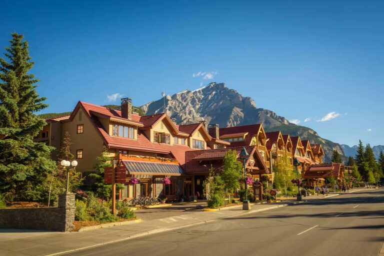
It is one of the most famous mountains in the area because, together with Cascade Mountain, it is the first mountain visitors see when they enter the town.
Standing at an elevation of “just” 1,692 meters (5,551 ft), it comes across as a hill among the surrounding Rockies. However, it is a popular destination for hiking.
The views from Tunnel Mountain are spectacular, and the summit provides panoramic views of the town, the Bow Valley, and the majestic Rundle Mountain.
Its summit is the perfect location to take in the scenery. The size of the mountain makes it an ideal spot for all levels of hikers because the trail to the top is relatively easy to manage.
5. Mount Rundle

Mount Rundle is one of the most prominent and well-known mountains in Banff National Park. It stands at an impressive 2,948 meters (9,672 ft) and is an excellent destination for mountaineering and hiking.
Named in 1884 after Reverend Robert Rundle, who explored the area in the early 1800s, Mount Rundle is part of the Front Ranges of the Canadian Rockies and visible from many parts of the town of Banff.
The challenging ascent to Mount Rundle’s summit takes about nine hours (15.1 km) out and back and involves a difficult scree scramble.
Scrambling along steep, icy sections and trying to find holds on loose rocks is a challenge you should not take lightly. Remember that the weather can change in minutes, and the temperature can drop significantly at night.
In summer, Mount Rundle ushers in incredible views of Bow Lake, Cascade Mountain, the town of Banff and Vermilion Lakes.
6. Sulphur Mountain

Sulphur Mountain is one of the most famous mountains in Banff National Park. It is a 2,451 meters (8,041 ft) high mountain that offers incredible vistas of the surrounding mountain peaks, the town of Banff and the Bow Valley.
You can approach the summit by the Banff Gondola or by following its lower slopes and switchback trails. The summit is also an excellent spot for picnicking and having a relaxing afternoon.
Sulphur Mountain is of significant importance to the birth of Banff National Park. The mountain was named for the hot spring on its flanks, discovered in 1883 by Canadian Pacific Railway employees. The discovery led to the park’s development.
7. Norquay Mountain

Norquay Mountain is just minutes from the town of Banff. It stands prominently at an elevation of 2,133 meters (6,998 ft) and is home to one of the three ski resorts in the park.
It was named for John Norquay (1841-1889), premier of Manitoba from 1878 to 1887, before becoming a railway commissioner.
In the summer, it provides chairlift rides, viewing platforms, mountain biking, and via ferrata, making it a popular destination for both locals and visitors.
The alpine pasture that borders the road running up Norquay Mountain provides a fantastic view of the town of Banff, Vermilion Lakes, Mount Rundle and the Bow River cutting through the landscape.
The views of the jagged Rocky Mountains, Lake Minnewanka, and the nearby town of Banff are a sight to behold.
8. Mount Bourgeau

At an elevation of 2,931 meters (9,616 ft), Mount Bourgeau is the prominent peak that is visible at Vermilion Lakes when looking to the west.
Its massive snowcapped peak makes for an impressive sight. In 1860, James Hector gave the mountain Eugène Bourgeau’s name in honor of the botanist who was a member of the Palliser Expedition.
Part of the Massive Range, Mount Bourgeau is renowned for its wildlife and incredible wildflower meadows, which bloom in summer. It is a popular destination for experienced hikers and climbers, thanks to its unique terrain and the challenge it presents.
There is an established route to reach the summit; however, hikers must be well-prepared for the intense 24-kilometer (14.91 miles) hike that takes about 8 to 10 hours to complete (out and back).
9. Mount Brett

Mount Brett is the highest summit in the Massive Range near the Continental Divide at an elevation of 2,984 meters (9,790 ft). The peak’s conical shape and steep rocky sides make it a striking sight. It’s located immediately to the right of Mount Bourgeau.
In 1916, it was named after Robert Brett (1851-1929) in honor of the surgeon and Alberta politician who arrived in Banff in 1885.
The easiest route to the top of Mount Brett is rated Class 3 (scrambling; a rope might be carried) and includes some hands-on climbing and sustained scrambling.
It’s 24.5 kilometers (15.22 mi) long and takes about 10 hours out and back. Close to the summit, the climb becomes a bit risky, so avoid this hike if you’re a novice hiker.
A traverse from Mount Brett to Pilot Mountain is possible. However, it is a complicated and long 12-hour route.
10. Castle Mountain

The aptly named Castle Mountain is, without a doubt, one of the most iconic and recognized peaks in the park. It is the easternmost peak of the Main Ranges in the Bow Valley. The mountain stands at 2,766 meters (9,075 ft) and is highly visible from the nearby Trans-Canada Highway (Highway 1).
The overlapping layers of softer shale and harder limestone, dolomite, and quartzite that make up the mountain’s peak erode at various rates and give the mountain a castle-like look.
When explorer James Hector passed the mountain for the first time in 1958, he noted the castle-like shape and dubbed it Castle Mountain.
Castle Mountain is a popular spot for alpine-style rock climbing. Numerous hiking trails lead up the mountain. The most popular ones are Brewer Buttress and the southeast face of Eisenhower Tower on the upper cliffs.
Nearby Castle Junction has a campground and a hostel close to the hiking trails. There’s also a tiny shop with a limited offering of groceries.
From Castle Mountain, you have beautiful views of the Bow Valley and the nearby peaks.
11. Mount Assiniboine

Mount Assiniboine is one of the most famous mountains in Banff National Park. It’s considered the “Matterhorn of the Canadian Rockies” as it somewhat resembles this mountain in the European Alps.
Located in an isolated location along the Continental Divide, which runs along the Alberta/British Columbia border, it rises to an impressive 3,618 meters (11,870 ft).
It’s easily one of the most prominent peaks in the region. Mount Assiniboine is located between the delta of the Simpson River and Lake Magog and is also part of Mount Assiniboine Provincial Park in BC. It was named by George Dawson in 1885. He observed a cloud plume extending from the top, bringing to mind the smoke plumes emanating from the Assiniboine people’s teepees.
It’s a hikers’ playground. Its steep slopes provide a challenging climb, rewarding you with stunning views. Due to its remote location, accessing the mountain requires traveling there via helicopter, horse or foot as there is no vehicle access.
The summit of Mount Assiniboine offers a sweeping panorama of the Canadian Rockies. On a clear day, climbers can experience views of glacial crevasses, blue-tinged ice fields, and the jagged peaks of the Rockies.
Mount Assiniboine was featured on the 2016 Canadian Silver Dollar coin.
12. Mount Babel

Mount Babel is a popular mountain for climbers. Measuring 3,101 meters (10,174 ft), it stands at the northern end of the Bow Range, dominating the surrounding landscape near the majestic Moraine Lake.
It’s composed of sedimentary rock and can be seen from the lake’s Valley of the Ten Peaks. It was named in 1899 by explorer Walter D. Wilcox, as the mountain’s profile reminded him of the biblical Tower of Babel.
The hike to the top of this rock formation, starting at Moraine Lake’s rock pile, is highly rewarding. Though it’s not your typical hike. It’s a scramble involving precarious scree (a mass of small loose stones).
Bringing a hiking pole and a helmet is therefore highly recommended. Once at the top, you’ll have a fantastic bird’s eye view of the Valley of the Ten Peaks and Moraine Lake.
This is also a great place to spot some of the region’s wildlife, including bighorn sheep and elk.
13. Mount Allen

Mount Allen is a prominent peak in Banff, which stands at an impressive 3,310 meters (10,860 ft). It is peak six of the Valley of the Ten Peaks and the second-highest (after Deltaform Mountain, which is 3,424 meters high). Mount Allen is part of the Continental Divide and is composed of sedimentary rock.
In 1924, James Monroe Thorington named this mountain for the American cartographer Samuel Evans Stokes Allen, who mapped this area of the Rockies in 1894-1895. Earlier, Allen had, in turn, called this mountain “Shappee”, the Stoney word for “six”.
Mount Allen is home to some interesting vegetation, including old-growth spruce, Douglas Fir, and subalpine fir. There are also many wildflowers in the area and alpine meadows and marmots.
14. Mount Temple

Mount Temple is located near the border between Alberta and British Columbia, just south of Lake Louise and easily visible from the Trans-Canada Highway (Highway 1). No wonder, as it stands an impressive 3,543 meters (11,624 ft) tall.
It is the tallest mountain in the Lake Louise area and one of the tallest mountains in the entire park, for that matter. Sir Richard Temple, a British colonial administrator who visited the Canadian Rockies in 1884, inspired Canadian geologist and surveyor George Mercer Dawson to give the mountain his name.
Mount Temple is a famous scramble among mountaineers, with several routes leading onto the mountain. The East Ridge is among the 50 classic climbs in North America. A helmet is highly recommended, as the scramble involves a lot of scree.
From the snowcapped summit, you can get a stunning panorama of the Valley of the Ten Peaks, glaciers, lush valleys, mesmerizing Moraine Lake and other glimmering lakes.
15. Mount Whyte

Mount Whyte is one of the mountains surrounding the world-famous Lake Louise and is visible from the Trans-Canada Highway (Highway 1). It stands 2,983 m (9,787 ft) tall. The mountain was named after the representative of the Canadian Pacific Railway, William Whyte, in 1898.
Mount Whyte, which also forms the backdrop for Lake Agnes, is considered one of the area’s more challenging summits in terms of difficulty. Many mountaineers take rock gear to get to the summit of this scramble.
The reward, however, is very much worth it. The summit offers expansive views, including the Valley of the Ten Peaks and Moraine Lake and the Victoria glacier, famously looming over Lake Louise.
16. Mount Victoria

Mount Victoria is the third-highest peak of the Bow Range, named after the Bow River. It stands at an elevation of 3,464 meters (11,365 ft), right on the border of Alberta and British Columbia. In case you’re not sure which mountain I’m talking about: It’s the one on the east shore of Lake Louise when standing in front of the hotel Fairmont Château Lake Louise.
The mountain was named by British scientist and mountaineer John Norman Collie in 1897 for Queen Victoria.
Mount Victoria forms part of the Continental Divide. It is composed mainly of limestone and shale of the Palliser Formation. It is a popular spot for mountaineers and climbers to summit, as the terrain and rocks make for ideal climbing conditions. The abundance of snow makes the climb challenging. The mountain is usually climbed as a multi-day backpacking trip.
Popular routes to the summit include the Northwest and Southeast ridge, the latter being the safest. The snow and ice around the summit, especially on the Southeast Ridge and at the mountain’s base, remain well into the summer.
17. Mount St. Piran

Mount St. Piran, measuring 2,649 meters (8,691 ft) in elevation, is one of the peaks of the Bow Range and bordering on the famous Lake Louise. In 1894, American explorer and mountaineer Samuel E.S. Allen named it after Saint Piran, the Patron Saint of Cornwall in England.
Hikers exploring the south-facing route will find an easy and rewarding day hike, passing Mirror Lake and Lake Agnes with its famous tea house.
If you have enough time, take a break here. It’s a fantastic place to sit down, savor the views and replenish your energy. During the hike, you’ll get amazing views of Lake Louise and the hotel Fairmont Château Lake Louise.
Once at the top, you’ll be rewarded with stunning views of the area. There are windbreaks at the top, providing refuge from the strong gusts that roam freely on the barren terrain.
18. Mount Hector

Mount Hector is located just north of Lake Louise beside the Icefields Parkway. It stands at a majestic 3,394 meters (11,135 ft).
It is immediately recognizable due to its rocky and jagged edges near the top. In 1884, George M. Dawson named it after the geologist on the Palliser expedition James Hector.
The mountain, composed of sedimentary rock, can be climbed all year, though early summer is the best (safest) time for most hikers. Be extra careful in winter, as avalanches present a significant risk. The section near the top is a scramble, and roping up is necessary.
The hike provides spectacular views of seemingly infinite mountain peaks, icefields and, of course, Hector Lake, situated on the other side of the Icefields Parkway.
19. Mount Chephren

Mount Chephren is also situated along the Icefields Parkway. It stands tall at 3,266 meters (10,715 ft) in elevation. British scientist and mountaineer John Norman Collie named it Pyramid Mountain in 1897. However, in 1924 it got its current name as it conflicted with another peak with the same name in Jasper National Park.
Mount Chephren, part of the Waputik Range, stands out from the rest of the Canadian Rockies thanks to its unique triangular shape and prominent face, making it one of the most iconical mountains on the Icefields Parkway.
It’s primarily a giant boulder and requires good rock scrambling skills to climb. From the Icefields Parkway, you can hike up all the way to the top. It’s a challenging 22.4-kilometer (13.92 mi) hike, out and back, with a long approach. Count on spending between 11 and 13 hours (start early if you want to complete it the same day).
The reward is well worth the effort. Rising above the tree line provides beautiful views of the Canadian Rockies, the Icefields Parkway, Chephren Lake and Waterfowl Lakes.
Overview of the Mountains (Handy Table and Map)
Below you’ll find an overview of the mountains listed above so you can quickly scan their elevation, prominence and their first ascent. I also posted a map indicating the location of all 19 peaks on the map. All, except Mount Assiniboine, you could – theoretically – see in one day.
| MOUNTAIN | ELEVATION | PROMINENCE* | FIRST ASCENT |
|---|---|---|---|
| Mount Peechee | 2,935 m (9,629 ft) | 160 m (520 ft) | 1929 |
| Mount Girouard | 2,995 m (9,826 ft) | 1,455 m (4,774 ft) | 1938 |
| Cascade Mountain | 2,998 m (9,836 ft) | 938 m (3,077 ft) | 1887 |
| Tunnel Mountain | 1,692 m (5,551 ft) | 305 m (1,001 ft) | – |
| Mount Rundle | 2,948 m (9,672 ft) | 1,304 m (4,278 ft) | 1888 |
| Sulphur Mountain | 2,451 m (8,041 ft) | 670 m (2,200 ft) | – |
| Norquay Mountain | 2,133 m (6,998 ft) | 565 m (1,854 ft) | 1917 |
| Mount Bourgeau | 2,931 m (9,616 ft) | 462 m (1,516 ft) | 1890 |
| Mount Brett | 2,984 m (9,790 ft) | 899 m (2,949 ft) | 1916 |
| Castle Mountain | 2,766 m (9,075 ft) | 168 m (551 ft) | 1884 |
| Mount Assiniboine | 3,618 m (11,870 ft) | 2,086 m (6,844 ft) | 1901 |
| Mount Babel | 3,101 m (10,174 ft) | 200 m (680 ft) | 1910 |
| Mount Allen | 3,310 m (10,860 ft) | 260 m (850 ft) | 1904 |
| Mount Temple | 3,543 m (11,624 ft) | 1,554 (5,066 ft) | 1894 |
| Mount Whyte | 2,983 m (9,787 ft) | 140 m (460 ft) | 1901 |
| Mount Victoria | 3,464 m (11,365 ft) | 547 m (1,795 ft) | 1897 |
| Mount St. Piran | 2,649 m (8,691 ft) | 187 m (614 ft) | 1898 |
| Mount Hector | 3,394 m (11,135 ft) | 1,795 m (5,771 ft) | 1895 |
| Mount Chephren | 3,266 m (10,715 ft) | 443 m (1,453 ft) | 1913 |
* Prominence is the least vertical distance from a mountain’s summit to the nearest other higher terrain.
Below you’ll find the map indicating all 19 mountains: