11 Easy Hikes Near the Town of Banff
Like to go on a hike, but prefer one that’s not too difficult and time-consuming? Many easy hikes near the town of Banff present you with beautiful nature and mesmerizing vistas. Find out below which one could be your wonderful next hike.
Maybe you don’t have too much time, have small kids, or don’t feel like putting too much effort. There are many reasons you’d want to go for a quick hike.
The good news is that hiking in Banff doesn’t have to be strenuous and challenging. This post is for you if you’re looking for an exciting pastime activity without spending all day.
CAVEAT: What’s easy for me might not be easy for you and vice versa. It’s a matter of perception and fitness, right? So, how to determine what’s easy?
Good independent indicators are distance, duration and elevation. At the bottom of this post, you’ll find a table with the hikes described below, allowing you to see these variables at a glance. It might help you decide which is the best suitable hike for your situation. Okay, let’s dive in
If you have a disability or you are physically challenged, the hikes you’ll find below might not be possible for you. Check the post How Accessible is Banff for Disabled Persons to learn about the possibilities you do have.
List of Easy Hikes Near Banff
Below I listed 11 hikes in the vicinity of the town of Banff. So if you’re staying there, you won’t need much time to get to the trailhead. I provided a short description of the trail and what you can expect.
I also indicated the distance, duration and elevation, which gives you an idea of the effort required.
Cascade Falls
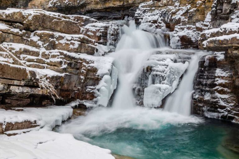
This trail leads you to the waterfall on the iconic Cascade Mountain, the mountain towering over Banff Avenue to the north. It’s a short and easy hike to the waterfall, although it has a steep incline of about 400 meters (1312 ft). You’ll be rewarded with a beautiful view of the Bow Valley at the falls.
The trail is open year-round but be careful in winter because the path is near an avalanche area. It’s also recommended to use crampons as the path can be slippery. The reward is a frozen waterfall, providing you with an extraordinary image.
Trailhead
Coming from the town of Banff, the trailhead is on the left side of Minnewanka Scenic Drive at the small roadside parking lot. You’ll find it 300 meters (328 yds) after you’ve passed underneath the Trans-Canada Highway.
Distance: 1.29 km (0.8 mi)
Duration: 35 min
Elevation gain: 60 m (197 ft)

Fairmont Golf Course Loop
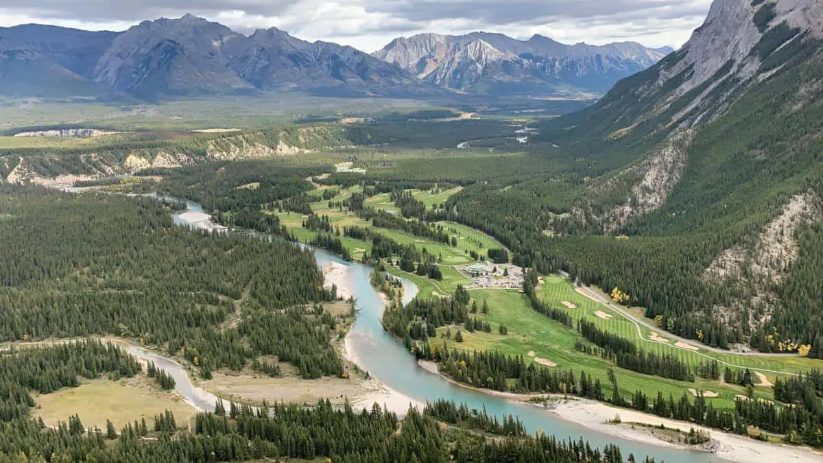
The Fairmont Golf Course Loop takes you – as the name suggests – along the Fairmont Banff Springs Golf Course. It’s an easy hike past most holes this course has to offer. There can be cars on the road, but very few in general. The loop also takes you past the Devils Cauldron, the course’s signature hole.
There are hardly any elevation differences, making this loop a perfect opportunity for a leisurely afternoon stroll.
Trailhead
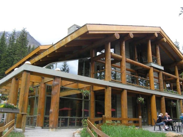
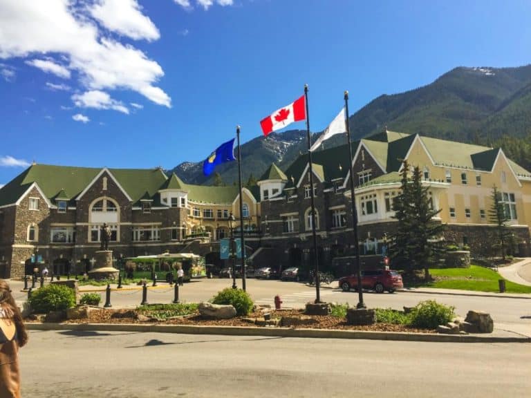
The trailhead is at the Bow Falls, behind the Fairmont Banff Springs Hotel.
Distance: 5km (3.1 mi)
Duration: 1 hour
Elevation gain: –
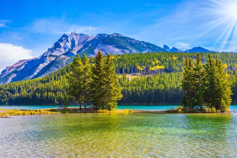
Fenland Trail to Vermilion Lakes
The Fenland Trail makes for a delightful little jaunt for families in the vicinity of Vermilion Lakes. This foresty loop near Vermilion Lakes and along Echo Creek can easily be reached from the town of Banff and is very easy to walk, but don’t forget to take bug spray in summer!
In this wetland environment, you can see the mountains through the trees. Expect other people on the path as it’s a popular trail, also used by mountain bikers. The noise from the cars on the nearby Trans-Canada Highway is a downside. The trail is open year-round.
Trailhead
The trailhead is on the left, off Mt Norquay Road, heading north toward the highway intersection.
Distance: 1.77 km (1.10 mi)
Duration: 30 min
Elevation gain: 55 m (180 ft)
Marsh Loop Trail
This excellent trail starts in the Case and Basin area near the Bow River, to the south of the town of Banff. The trail offers many magnificent views of the Bow River and the Bow Valley. Even though you’re very close to Banff, you’ll feel like you’re in the wild.
The trail itself is beautiful and well maintained by Parks Canada. It consists of bridges, boardwalks and some small sets of stairs. Wildlife sightings are plentiful along this trail, making this a very rewarding hike.
Besides easy it’s also family-friendly. There’s a big parking lot at the Cave and Basin site. Highly Recommended.
Trailhead
Pass the main building at the end of the Cave and Basin area. On the right side, you’ll find signs for the Marsh Loop.
Distance: 2.77 km (1.72 mi)
Duration: 35 min
Elevation gain: 102 m (335 ft)
Spray River Loop
This loop is quite long and therefore it may not qualify as easy. However, the elevation gain throughout the loop is minimal as the trail runs through the valley bottom, which makes it a relatively easy hike.
If you have more time on your hands and want to do a hike that’s not too strenuous I can highly recommend this hike.
You’ll be well rewarded for your efforts because the views along the route – that follows the course of the Spray River – are gorgeous. Okay, maybe not as jaw-dropping as the views some higher elevation hikes provide, but still well worth the effort.
Even though the trail is easy to access from the town of Banff, it is generally not busy at all. In other words: An excellent hike to escape the summer crowds.
Trailhead
You’ll find the Spray River loop trailhead at the Spray West parking lot behind the Fairmont Banff Springs Hotel. On Spray Avenue, you’ll pass the hotel on your left-hand side. At the end of the road there’s a traffic circle.
Go straight ahead and you’ll pass under a pedestrian bridge. Continue beyond the hotel’s parkade at your right-hand side and keep right to get to the Spray parking and the trailhead.
Distance: 12.23 km (7.58 mi)
Duration: 3.5 – 5 hours
Elevation gain: 519 m (1703 ft)
Stewart Canyon Trail
You’ll find the Stewart Canyon trail near Lake Minnewanka. Close to Banff this 2-hour hike doesn’t require too much effort and provides you with many stunning views. It’s a very family-friendly trail that’s not very crowded, contrary to the Lakeshore itself, which can be extremely busy in summer.
The trail contains the famed bridge from the 1954 movie River of No Return, starring Marilyn Monroe. The trail is not a loop, so you need to return the way you came. You can park your vehicle at the Lake Minnewanka day-use area if you arrive by car.
But beware, in summer it can be busy here. You can also take the Roam Transit bus if you don’t want to risk a fully occupied parking lot. Route 6 takes you there.
Trailhead
You’ll find the trailhead beyond Lake Minnewanka’s main dock area. First, go to the Lake Minnewanka day-use area (where you can park your car).
Distance: 6.76 km (4.19 mi)
Duration: 2 hours
Elevation gain: 257 m (843 ft)
Sulphur Mountain Lookout
Okay, I must admit this trail isn’t easy, as it takes 1.5 to 3 hours to reach the top and covers an elevation gain of 644 meters (2113 ft).
At the same time, it’s a relatively straightforward hike to the top and it’s much more rewarding to hike up to the summit than take the Banff Gondola up the mountain. The view of the Bow Valley and the town of Banff are stunning and well worth the effort.
At the top, you’ll be presented with the world-famous view of the Bow Valley and the town of Banff. There’s also a souvenir shop and the Sky Bistro restaurant where you can get a good lunch or dinner.
The boardwalk makes for a nice walk on the top of Sulphur Mountain and takes you to the old weather station. When you’re done, you can take the Banff Gondola back down for half price if you don’t want to walk.
The Sulphur Mountain Lookout trail is open year-round, but be wary of a slippery path in winter; ensure you have the right gear to hike to the top.
It’s also good to know that there’s another, much longer hike to the top of Sulphur Mountain. This trail starts near the Cave and Basin. The one described above begins at the Banff Gondola and the Hot Springs parking lot.
Trailhead
Follow Mountain Avenue, passed the Rimrock Resort Hotel, to the joint parking lot of the Banff Gondola and the Banff Hot Springs. You’ll find the trailhead left of the road leading up to the Hot Springs buildings.
Distance: 5.5 km (3.41 mi)
Duration: 1.5 – 3 hours
Elevation gain: 644 meters (2113 ft)
Sundance Canyon
This family-friendly trail (not for strollers) has a nice runup to the actual canyon, leading over a mostly flat paved road along the Bow River. At a length of 3.3 km (2.04 mi), this paved section is quite long so it could be a good idea to bike to the canyon section of the trail.
Once you arrive at the canyon, you cross a bridge over the creek that leads you onto the path that takes you through the canyon. You’ll be presented with big rocks and small waterfalls. In the middle of the loop there’s a spectacular viewpoint.
Trailhead
The trailhead for the Sundance Canyon trail is at the end of the Cave and Basin parking lot. However, the ‘real’ hike starts at the end of the paved path in the forest. From that point on
Distance: 9 km (5.58 mi)
Duration: 3 hours
Elevation gain: 351 m (1152 ft)
Surprise Corner Trail
This hike takes you through the town of Banff to a beautiful viewpoint up Tunnel Mountain that provides gorgeous views in many directions. The most famous view is, without a doubt, that of the Fairmont Banff Springs Hotel.
The trail takes you to the Bow River Bridge, south of Banff Avenue. Just before you turn left, you join the Bow River trail system.
Trailhead
Anywhere on Banff Avenue is okay if you head towards the Bow River Bridge.
Distance: 3 km (1.86 mi)
Duration: 1 hour
Elevation gain: 60 m (197 ft)
Don’t want to hike because it’s raining in the park? Click the link to get some cool ideas about what to do when it’s raining in Banff.
Surprise Corner to Hoodoos

Hiked the easy Surprise Corner and up for more? You can extend your hike by adding the Surprise Corner to Hoodoos trail to your itinerary. You can also park your car at the Surprise Corner parking lot and start your hike there.
Yes, this hike is long, but it’s also a hike with minimal elevation. It takes you along the Bow River and the backside of Tunnel Mountain while providing views of the mighty Mount Rundle.
After leaving the riverside, you’ll start to gain elevation, but this effort is rewarded with stunning new viewpoints and vistas.
You’ll find the hoodoos, desert-like eroded rock formations usually found in deserts at the trail’s end, yet here they are in the mountains. Wildlife sightings on this trail are pretty common, including bears, so make sure you take your bear spray.
Trailhead
The Surprise Corner parking lot on Buffalo Street and Tunnel Mountain Drive.
Distance: 10 km (6.2 mi)
Duration: 2.5 – 3.5 hours
Elevation gain: 305 m (1000 ft)
Tunnel Mountain Loop
This is another hike that you can start from Banff Avenue. If you don’t want that, you could park your car at the gravel car park on St Julien Road up Tunnel Mountain, adjacent to the Banff Centre. You cut through the trees until you reach another road, Tunnel Mountain Drive.
The trail continues on the other side of the road, characterized by quite a few switchbacks. The trail is not difficult, but it does require some effort to reach the top. There you’ll have a nice view over the town of Banff, which is a mere kilometer away, and the Bow Valley.
Trailhead
The trailhead is next to the car park on St. Julien Road. The trail starts on the left. You can also park your car on Tunnel Mountain Drive, a little higher up the mountain, though this lot is smaller than the one on St. Julien Road.
Distance: 4.3 km (2.66 mi)
Duration: 1.5 – 2 hours
Elevation gain: 300 m (984 ft)
If you want to get the most of your action camera in the park, I recommend reading the post Practical Guide to Recording Thrilling GoPro Videos in Banff.
Banff Easy Hikes Table
| TRAIL | DISTANCE | DURATION | ELEVATION GAIN | DISTANCE FROM BANFF |
|---|---|---|---|---|
| Cascade Falls | 1.29 km (0.8 mi) | 35 min | 60 m (197 ft) | 5.3 km (3.29 mi) |
| Fairmont Golf Course Loop | 5 km (3.1 mi) | 1 hour | – | 2.4 km (1.49 mi) |
| Fenland Trail to Vermilion Lakes | 1.77 km (1.10 mi) | 30 min | 55 m (180 ft) | 1.8 km (1.12 mi) |
| Marsh Loop Trail | 2.77 km (1.72 mi) | 35 min | 102 m (335 ft) | 2.1 km (1.30 mi) |
| Spray River Loop | 12.23 km (7.58 mi) | 3.5 – 5 hrs | 519 m (1703 ft) | 2.1 km (1.30 mi) |
| Stewart Canyon | 6.76 (4.19 mi) | 2 hrs | 257 m (843 ft) | 14.4 km (8.93 mi) |
| Sulphur Mountain Lookout | 5.5 km (3.41 mi) | 1.5 – 3 hrs | 644 m (2113 ft) | 4.1 km (2.54 mi) |
| Sundance Canyon | 9 km (5.58 mi) | 3 hours | 351 m (1152 ft) | 2.1 km (1.30 mi) |
| Suprise Corner | 3 km (1.86 mi) | 1 hour | 60 m (197 ft) | – |
| Surprise Corner to Hoodoos | 10 (6.2 mi) | 2.5 – 3.5 hrs | 305 m (1000 ft) | 1.5 km (0.93 mi) |
| Tunnel Mountain Loop | 4.3 km (2.66 mi) | 1.5 – 2 hrs | 300 m (984 ft) | 1.0 km (0.62 mi) |
What about cycling in and around the town of Banff? I wrote a post with the 6 must-do cycling routes in the town of Banff.